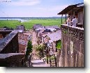
Město: Viscachune, Region: Puno

Zpět na článek: Peru (cestopis)


Navigace mapy Celého Světa online: Kliknutím a tažením na mapě Celého světa, nebo použijte zoom kontrol.

Zeměpisná šířka:

-16,7833 (16°46'59.880"S)

Zeměpisná délka:

-69,8000 (69°47'60.000"W)

Nadmořská výška:

4 325 m

Článek: Peru (cestopis)

Největší města: Peru (cestopis)

Foto, fotky: Peru (cestopis)

všechna města: Peru (cestopis)

Fórum: Peru (cestopis)

Největší města světa

GMT čas: -5 hodin

Posun oproti ČR: -6 hodin

Vzdálenost města Viscachune do 25 největších měst státu: Peru (cestopis)

Přímá vzdálenostKm
 Viscachune - Lima  942 km
 Viscachune - Arequipa  190 km
 Viscachune - Callao  950 km
 Viscachune - Trujillo  1 390 km
 Viscachune - Chiclayo  1 559 km
 Viscachune - Iquitos  1 498 km
 Viscachune - Huancayo  786 km
 Viscachune - Piura  1 747 km
 Viscachune - Chimbote  1 281 km
 Viscachune - Cusco  432 km
 Viscachune - Ciudad Del Cuzco  432 km
 Viscachune - Pucallpa  1 066 km
 Viscachune - Callaria  1 066 km
 Viscachune - Tacna  144 km
 Viscachune - Juliaca  147 km
 Viscachune - Ica  703 km
 Viscachune - Sullana  1 776 km
 Viscachune - Chincha Alta  774 km
 Viscachune - Huanuco  1 033 km
 Viscachune - Ayacucho  623 km
 Viscachune - Cajamarca  1 429 km
 Viscachune - Puno  109 km
 Viscachune - Chosica  919 km
 Viscachune - Tumbes  1 874 km
 Viscachune - Talara  1 846 km

Vzdálenost města: Viscachune do Top 10 měst světa

Přímá vzdálenostKm
 Viscachune - Praha  11 035 km
 Viscachune - Berlín  11 035 km
 Viscachune - Londýn  10 132 km
 Viscachune - Los Angeles  7 633 km
 Viscachune - Moskva  12 633 km
 Viscachune - New York  6 410 km
 Viscachune - Paříž  10 165 km
 Viscachune - Peking  17 378 km
 Viscachune - Rio De Janeiro  2 857 km
 Viscachune - Sydney  12 905 km
 Viscachune - Tokio  16 424 km


Navigace: A B C Č D E F G H I J K L M N O P Q R Ř S Š T U V W X Y Z Ž VŠE

Podpořte nás · Kontakt· Kniha návštěv · RoboStav
Copyright (c) 2025 by CELÝSVĚT. Všechna práva vyhrazena!
Kontaktní e-mail: celysvet(zav)email.cz


Viscachune
Viscachune


Viscachune
Viscachune


Viscachune
Viscachune


Viscachune
Viscachune


Viscachune
Viscachune


Fotogalerie ()...


Přidat foto...


Poradna
Poradna
Poslední dotazy:
HELP !


IQ test online

Hry online
Svátek má  Ingrid, zítra Otýlie